forked from kamba4/sunders
click on cameras not working #1
Loading…
Add table
Add a link
Reference in a new issue
No description provided.
Delete branch "%!s()"
Deleting a branch is permanent. Although the deleted branch may continue to exist for a short time before it actually gets removed, it CANNOT be undone in most cases. Continue?
FYI: The instance hosted on
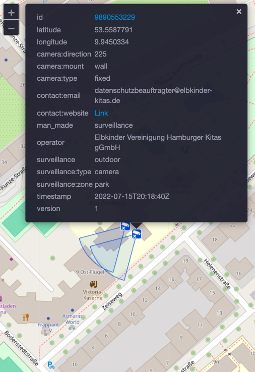
uber.spaceseems to work fine.Having said that, if I clone and run
522c609ef1locally, the issue still occurs.Just to document it (maybe you already found it): Your suspicion of missing data being the root cause seems to be correct.
Adding a fallback value to
camera:typeresults in working tooltips (but incorrect visualizations, as now every camera is treated as a 360° camera:From what I can see, the script generates the field of view of the camera (called
plotFocusin that file) based on the type of camera. With that data missing, the script fails inside themap.addLayer()call, which throws and forces the script to exit.Once the initialization and update script supplies that data (#3), the tooltips should work!
works now. was a problem with the data in the old data-dump